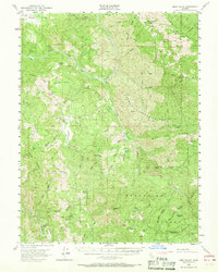
1952 Map of Eden Valley
USGS Topo · Published 1968About this map
Mt Sanhedrin towers over this mid-century landscape in the heart of the Mendocino National Forest, where the topography is defined by the winding course of the Middle Fork Eel River. The map captures a moment when the rugged interior of Mendocino County was navigated primarily by primitive routes, including a notable Jeep Trail and several private roads. Isolated holdings like Eden Valley Ranch and Elk Creek Ranch mark the few signs of permanent habitation among the steep slopes of Horse Pasture Ridge and Long Ridge.
Find a feature on this map
76 named features on this map. Tap any name to fly to it.
Don’t see what you’re looking for? This feature index may not catch every label — zoom into the map to look around manually.
Map Details
Editions of this 1952 Eden Valley Map
4 editions found

Other maps of this area

1920 · Covelo
USGS Topo · 1:62,500

1922 · Willits
USGS Topo · 1:62,500

1922 · Hullville
USGS Topo · 1:62,500

1926 · Covelo
USGS Topo · 1:62,500

1929 · Eden Valley
USGS Topo · 1:62,500

1942 · Willits
USGS Topo · 1:62,500

1943 · Pomo
USGS Topo · 1:62,500

1944 · Willits
USGS Topo · 1:62,500

1951 · Lake Pillsbury
USGS Topo · 1:62,500

1951 · Laytonville
USGS Topo · 1:62,500