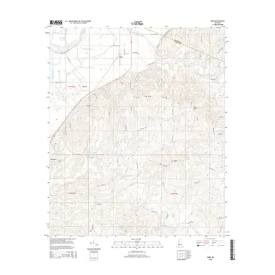
2015 Map of Eden
USGS Topo · Published 2015About this map
The Yazoo River defines the northwestern edge of this landscape, where the alluvial plain meets the rising loess bluffs of Yazoo County. The small settlement of Eden sits at the base of these hills, serving as a focal point for a network of rural roads like Eden Main St and Eden Midway Rd. To the east, the terrain becomes increasingly dissected by numerous drainages, including Tesheva Creek and Piney Cr, creating a complex topography of ridges and hollows.
Find a feature on this map
61 named features on this map. Tap any name to fly to it.
Don’t see what you’re looking for? This feature index may not catch every label — zoom into the map to look around manually.
Map Details
Editions of this 2015 Eden Map
This is the sole edition of this map. No revisions or reprints were ever made.
Other maps of this area
1940 · Lexington
USGS Topo · 1:62,500
1940 · Mileston
USGS Topo · 1:62,500

1953 · Greenwood
USGS Topo · 1:250,000
1954 · Mileston
USGS Topo · 1:62,500

1955 · Jackson
USGS Topo · 1:250,000

1956 · Greenwood
USGS Topo · 1:250,000
1957 · Lexington
USGS Topo · 1:62,500
1958 · Lexington
USGS Topo · 1:62,500

1961 · Jackson
USGS Topo · 1:250,000
1961 · Valley
USGS Topo · 1:62,500