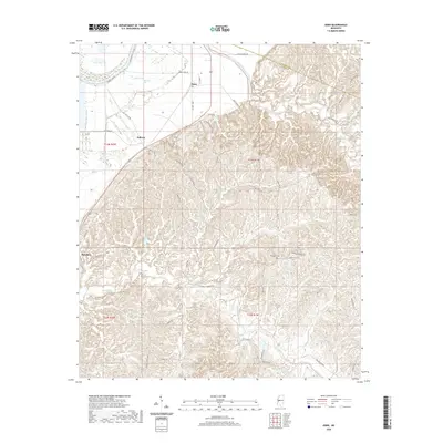
2020 Map of Eden
USGS Topo · Published 2020About this map
Eden and the surrounding Yazoo County countryside appear here as a landscape defined by the sharp transition between the alluvial Mississippi Delta and the dissected upland hills. The Yazoo River skirts the western edge of the map, fed by a complex drainage system including Dead Man Bayou and Old Cr. While the western portion is dominated by flat, low-lying bottomlands and features such as Ingersoll Lake, the eastern half rises into a densely contoured ridge system.
Find a feature on this map
56 named features on this map. Tap any name to fly to it.
Don’t see what you’re looking for? This feature index may not catch every label — zoom into the map to look around manually.
Map Details
Editions of this 2020 Eden Map
This is the sole edition of this map. No revisions or reprints were ever made.
Other maps of this area

1940 · Lexington
USGS Topo · 1:62,500

1940 · Mileston
USGS Topo · 1:62,500

1953 · Greenwood
USGS Topo · 1:250,000

1954 · Mileston
USGS Topo · 1:62,500

1955 · Jackson
USGS Topo · 1:250,000

1956 · Greenwood
USGS Topo · 1:250,000

1957 · Lexington
USGS Topo · 1:62,500

1958 · Lexington
USGS Topo · 1:62,500

1961 · Jackson
USGS Topo · 1:250,000

1961 · Valley
USGS Topo · 1:62,500