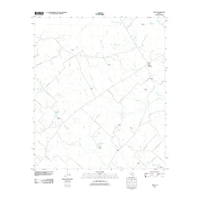
2010 Map of Edge
USGS Topo · Published 2010About this map
Edge and its surrounding rural communities in northern Brazos County are defined by a network of ranch roads and historic family-named burial grounds. This 2010 landscape remains largely agricultural, anchored by small settlements like Eaton and Macey. The terrain is drained by numerous winding waterways, including Devils Jump Creek to the north and Jack Creek to the south. A significant corridor is formed by the Kings Highway and the E Osr, marking old travel routes that have persisted for generations. Several man-made reservoirs, such as Matejka Lake and Stuewe Lake, indicate the importance of water management for local ranching operations like the Cavitt Ranch. Genealogists will find this map particularly useful for locating dispersed family sites, including the Anderson Cemetery, Shiloh Cemetery, and House Cemetery, which are tucked away along gravel routes like Edge School House Rd and Shiloh Church Rd.
Find a feature on this map
48 named features on this map. Tap any name to fly to it.
Don’t see what you’re looking for? This feature index may not catch every label — zoom into the map to look around manually.
Map Details
Editions of this 2010 Edge Map
This is the sole edition of this map. No revisions or reprints were ever made.
Other maps of this area

1925 · Iola No 2
USGS Topo · 1:48,000

1925 · Marquez No. 4
USGS Topo · 1:48,000

1927 · Marquez
USGS Topo · 1:62,500

1930 · Marquez
USGS Topo · 1:62,500

1931 · Iola
USGS Topo · 1:62,500

1954 · Waco
USGS Topo · 1:250,000

1954 · Austin
USGS Topo · 1:250,000

1955 · Waco
USGS Topo · 1:250,000

1959 · Clear Lake
USGS Topo · 1:24,000

1962 · Edge
USGS Topo · 1:24,000