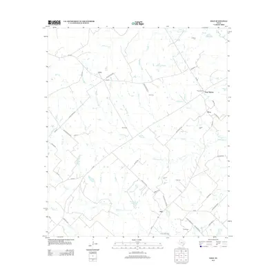
2013 Map of Edge
USGS Topo · Published 2013About this map
The community of Edge and the surrounding Brazos County landscape are documented in this 2013 survey, highlighting a rural region defined by its creek networks and family-named landmarks. Several small settlements including Eaton, Macey, and Kings Highway are distributed across the terrain, connected by a network of farm-to-market roads like FM-974 and FM-2446. The area is notably dense with historical burial grounds, including the Edge Cem, Shiloh Cem, and Anderson Cem, providing valuable touchpoints for genealogical research. Drainage is dominated by meandering waterways such as Little Cedar Cr, Snake Br, and Devils Jump Cr. Significant private holdings and water features like the Cavitt Ranch, Matejka Lake, and Stuewe Lake suggest a landscape primarily utilized for agriculture and ranching in the early 21st century.
Find a feature on this map
55 named features on this map. Tap any name to fly to it.
Don’t see what you’re looking for? This feature index may not catch every label — zoom into the map to look around manually.
Map Details
Editions of this 2013 Edge Map
This is the sole edition of this map. No revisions or reprints were ever made.
Other maps of this area

1925 · Iola No 2
USGS Topo · 1:48,000

1925 · Marquez No. 4
USGS Topo · 1:48,000

1927 · Marquez
USGS Topo · 1:62,500

1930 · Marquez
USGS Topo · 1:62,500

1931 · Iola
USGS Topo · 1:62,500

1954 · Waco
USGS Topo · 1:250,000

1954 · Austin
USGS Topo · 1:250,000

1955 · Waco
USGS Topo · 1:250,000

1959 · Clear Lake
USGS Topo · 1:24,000

1962 · Edge
USGS Topo · 1:24,000