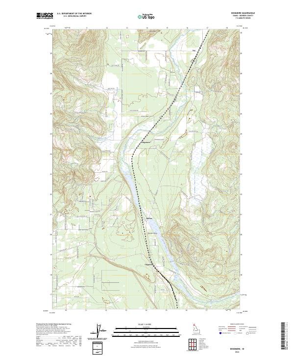
2024 Map of Edgemere
USGS Topo · Published 2024About this map
Hoodoo Valley forms the central corridor of this North Idaho landscape, where the meandering course of Hoodoo Creek connects a series of small, rural settlements. The map highlights the community centers of Edgemere, Harlem, and Clagstone, which are linked by a network of local roads including Spirit Lake Cutoff and Vay Rd. To the north, the terrain rises toward Horn Mtn, while the southern reaches of the valley transition into more open wetlands and small tributaries like Curtis Creek. The inclusion of names like Old Schoolhouse Rd suggests the locations of earlier civic centers in this Bonner County timber and ranching region. The modern road network, including family-named routes such as Kendall Rd and Bandy Rd, provides a clear view of contemporary land divisions and residency patterns within the valley's distinct topography.
Find a feature on this map
71 named features on this map. Tap any name to fly to it.
Don’t see what you’re looking for? This feature index may not catch every label — zoom into the map to look around manually.
Map Details
Editions of this 2024 Edgemere Map
This is the sole edition of this map. No revisions or reprints were ever made.
Other maps of this area

1901 · Sandpoint
USGS Topo · 1:125,000

1903 · Rathdrum
USGS Topo · 1:125,000

1911 · Priest Lake
USGS Topo · 1:250,000

1911 · Sandpoint
USGS Topo · 1:125,000

1913 · Priest Lake
USGS Topo · 1:250,000

1955 · Spokane
USGS Topo · 1:250,000

1958 · Spokane
USGS Topo · 1:250,000

1958 · Sandpoint
USGS Topo · 1:250,000

1961 · Spirit Lake East
USGS Topo · 1:24,000

1961 · Athol
USGS Topo · 1:24,000