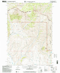
1997 Map of Edie Creek
USGS Topo · Published 2002About this map
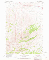
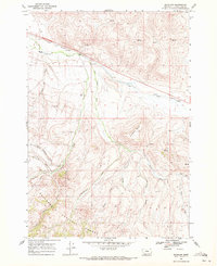
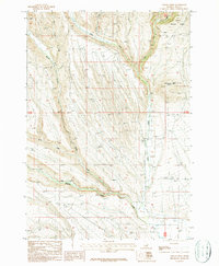
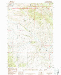
The Continental Divide forms the primary geographic spine of this high-altitude landscape, tracing the state line between Montana and Idaho. This high mountain terrain is largely managed by the Beaverhead National Forest to the north and the Targhee National Forest to the south. Distinctive peaks such as Red Conglomerate Peaks, Knob Mountain, and The Thumb define the high ridges of the Beaverhead Mountains. Drainage patterns are clearly marked by the eponymous Edie Creek and the southern flow of Medicine Lodge Creek. The map documents a sparsely settled wilderness region, characterized by numerous canyons like Bear Canyon and Deer Canyon, where a complex network of seasonal drainages and isolated springs, including Edie Spring, provide the only consistent water sources for high-country grazing or recreation.
Find a feature on this map
28 named features on this map. Tap any name to fly to it.
Don’t see what you’re looking for? This feature index may not catch every label — zoom into the map to look around manually.
Map Details
Editions of this 1997 Edie Creek Map
This is the sole edition of this map. No revisions or reprints were ever made.
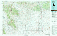
Other maps of this area

1955 · Dubois
USGS Topo · 1:250,000
1957 · Paul Reservoir
USGS Topo · 1:62,500
1957 · Edie Ranch
USGS Topo · 1:62,500

1958 · Dubois
USGS Topo · 1:250,000
1965 · Gallagher Gulch
USGS Topo · 1:24,000
1965 · Lima Peaks
USGS Topo · 1:24,000
1968 · Snowline
USGS Topo · 1:24,000
1983 · Dubois
USGS Topo · 1:100,000
1987 · Indian Creek
USGS Topo · 1:24,000
1987 · Fritz Peak
USGS Topo · 1:24,000