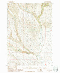
1987 Map of Indian Creek
USGS Topo · Published 1987About this map
Targhee National Forest defines the northern reaches of this Idaho landscape, where high-elevation drainage patterns converge into the Medicine Lodge Creek valley. The map documents a rugged transition where the West Fork Indian Creek, Middle Fork Indian Creek, and East Fork Indian Creek come together near the prominent Indian Creek Butte. This area reflects the mid-1980s ranching and agricultural footprint, anchored by specific landmarks such as Grain Bins and a Gravel Pit. Further south, the flow of Middle Fork Medicine Lodge Creek joins with Lodge Creek, illustrating the vital water network that sustained the high desert ranching economy. For genealogists and local historians, the presence of a small Cem (cemetery) provides a poignant connection to the early families who settled this corner of Clark County.
Find a feature on this map
15 named features on this map. Tap any name to fly to it.
Don’t see what you’re looking for? This feature index may not catch every label — zoom into the map to look around manually.
Map Details
Editions of this 1987 Indian Creek Map
This is the sole edition of this map. No revisions or reprints were ever made.
Other maps of this area

1955 · Dubois
USGS Topo · 1:250,000

1957 · Paul Reservoir
USGS Topo · 1:62,500

1957 · Edie Ranch
USGS Topo · 1:62,500

1958 · Dubois
USGS Topo · 1:250,000

1964 · Lone Butte
USGS Topo · 1:24,000

1964 · Small
USGS Topo · 1:24,000

1969 · Lidy Hot Springs
USGS Topo · 1:24,000

1983 · Dubois
USGS Topo · 1:100,000
1987 · Thunder Gulch
USGS Topo · 1:24,000
1987 · Edie Creek
USGS Topo · 1:24,000