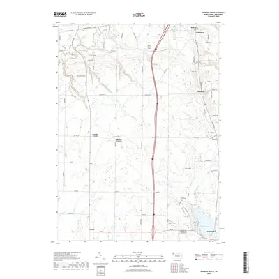
2019 Map of Edinboro North
USGS Topo · Published 2019About this map
Edinboro Lake and the northern reaches of Edinboro anchor the southern portion of this Erie County landscape, where the waters of Conneauttee Cr and Shenango Cr drain the glacial terrain. The map captures a network of small crossroad settlements and historic hamlets, including Branchville, McLane, and Mishler Corners. For genealogists, the map is particularly useful for locating small burial sites such as Allen Family Cem, Golden Cem, and Hauck Cem, often situated near family-named roads like Silverthorn Rd and Shadduck Rd. The transition from the rural northern townships toward the college town of Edinboro is marked by the path of Porter Run and the presence of the Dillen Personal Airport. This 2019 survey documents the enduring agricultural character of the region alongside modern transportation corridors like Edinboro Rd and the interstate.
Find a feature on this map
80 named features on this map. Tap any name to fly to it.
Don’t see what you’re looking for? This feature index may not catch every label — zoom into the map to look around manually.
Map Details
Editions of this 2019 Edinboro North Map
This is the sole edition of this map. No revisions or reprints were ever made.
Other maps of this area

1899 · Erie
USGS Topo · 1:62,500

1900 · Girard
USGS Topo · 1:62,500

1900 · Erie
USGS Topo · 1:62,500

1900 · Fairview
USGS Topo · 1:62,500

1923 · Cambridge Springs
USGS Topo · 1:62,500

1925 · Cambridge Springs
USGS Topo · 1:62,500

1943 · Cambridge Springs
USGS Topo · 1:62,500

1950 · Cleveland
USGS Topo · 1:250,000

1950 · Erie
USGS Topo · 1:250,000

1956 · Cleveland
USGS Topo · 1:250,000