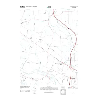
2013 Map of Edinburg
USGS Topo · Published 2013About this map
The Shenango River and Mahoning River converge in this portion of Lawrence County, framing a landscape defined by small valley settlements and rolling uplands. The village of Edinburg sits near the southern bend of the Mahoning, adjacent to the Mohawk Trails Golf Course, while the northern reaches are anchored by Pulaski along the Shenango. This 2013 survey illustrates the modern transition of the area, where rural crossroads like Frizzleburg and Nashua persist alongside larger infrastructure such as the New Castle Municipal Airport. Local history and genealogy researchers will find several distinct neighborhood clusters, including Peanut, Parkstown, and Oakwood, which reflect the historical expansion of community life between the river valleys. Landmark structures like Kings Chapel and the high elevations of High Hill and Bird Hill provide clear reference points for those tracing family property or regional development patterns in this part of western Pennsylvania.
Find a feature on this map
103 named features on this map. Tap any name to fly to it.
Don’t see what you’re looking for? This feature index may not catch every label — zoom into the map to look around manually.
Map Details
Editions of this 2013 Edinburg Map
This is the sole edition of this map. No revisions or reprints were ever made.
Other maps of this area

1902 · New Castle
USGS Topo · 1:62,500

1904 · Newcastle
USGS Topo · 1:62,500

1905 · Neshannock
USGS Topo · 1:62,500

1906 · Youngstown
USGS Topo · 1:62,500

1907 · Neshannock
USGS Topo · 1:62,500

1907 · Columbiana
USGS Topo · 1:62,500

1908 · Youngstown
USGS Topo · 1:62,500

1909 · Columbiana
USGS Topo · 1:62,500

1950 · Cleveland
USGS Topo · 1:250,000

1951 · Canton
USGS Topo · 1:250,000
Featured Places
- Pulaski Township, PA
- Frizzleburg, Pulaski Township
- Mahoning Township, PA
- Neshannock Township, PA
- Edinburg, Mahoning Township