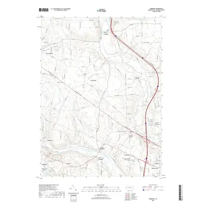
2019 Map of Edinburg
USGS Topo · Published 2019About this map
The Shenango River and Mahoning River converge in this corner of Lawrence County, Pennsylvania, shaping a landscape of deep-cut runs and clustered settlements. The corridor between Pulaski and Edinburg is defined by a series of small, historically distinct communities including Frizzleburg, Nashua, and the curiously named Peanut. This 2019 survey documents a modern landscape that still preserves its genealogical bones, from the Pulaski Cem in the north to the Ashton Cem near the riverbanks.
Find a feature on this map
43 named features on this map. Tap any name to fly to it.
Don’t see what you’re looking for? This feature index may not catch every label — zoom into the map to look around manually.
Map Details
Editions of this 2019 Edinburg Map
This is the sole edition of this map. No revisions or reprints were ever made.
Other maps of this area

1902 · New Castle
USGS Topo · 1:62,500

1904 · Newcastle
USGS Topo · 1:62,500

1905 · Neshannock
USGS Topo · 1:62,500

1906 · Youngstown
USGS Topo · 1:62,500

1907 · Neshannock
USGS Topo · 1:62,500

1907 · Columbiana
USGS Topo · 1:62,500

1908 · Youngstown
USGS Topo · 1:62,500

1909 · Columbiana
USGS Topo · 1:62,500

1950 · Cleveland
USGS Topo · 1:250,000

1951 · Canton
USGS Topo · 1:250,000
Featured Places
- Pulaski Township, PA
- Frizzleburg, Pulaski Township
- Mahoning Township, PA
- Neshannock Township, PA
- Edinburg, Mahoning Township