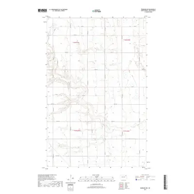
2017 Map of Edinburg NW
USGS Topo · Published 2017About this map
S Br Park River meanders across this rural section of Walsh County, defining the drainage patterns through a landscape of section lines and gravel roads. In this modern survey, the terrain is structured by a rigid grid of rural routes such as 124th Ave NE and 70th St NE, showing the persistent agricultural layout of the Red River Valley region. While the map is dominated by these township and range divisions, the presence of the Prairie Trl suggests contemporary land use and connectivity between farmsteads. State and county coordination is evident through infrastructure like Co Hwy 9 and Co Rd 11, which serve as the primary conduits for travel through these expansive northern plains near the turn of the twenty-first century.
Find a feature on this map
24 named features on this map. Tap any name to fly to it.
Don’t see what you’re looking for? This feature index may not catch every label — zoom into the map to look around manually.
Map Details
Editions of this 2017 Edinburg NW Map
This is the sole edition of this map. No revisions or reprints were ever made.
Other maps of this area

1952 · Thief River Falls
USGS Topo · 1:250,000
1953 · Devils Lake
USGS Topo · 1:250,000

1956 · Thief River Falls
USGS Topo · 1:250,000
1956 · Devils Lake
USGS Topo · 1:250,000

1957 · Thief River Falls
USGS Topo · 1:250,000
1963 · Edinburg
USGS Topo · 1:24,000
1963 · Pleasant Valley
USGS Topo · 1:24,000
1963 · Gardar
USGS Topo · 1:24,000
1967 · Thief River Falls
USGS Topo · 1:250,000
1972 · Adams
USGS Topo · 1:24,000