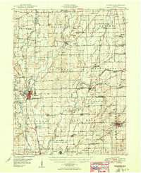
1950 Map of Edinburg
USGS Topo · Published 1950About this map
Edinburg sits at the confluence of the Blue River and Sugar Creek during the mid-century expansion of the midwest's military and rail infrastructure. This survey captures a landscape defined by the vast Camp Atterbury Military Reservation and the Atterbury Air Force Base, which occupy a significant portion of the western terrain. The arrival of the Pennsylvania and New York Central railroads facilitated the growth of rural hubs like Hope and Flat Rock, while the countryside remained dotted with local institutions such as Hendricks Township School and St George Church. The density of family burial grounds, including Rest Haven Cemetery and Moravian Cem, offers a detailed map for genealogical research. Industrial and civil markers, from the Tindall Dam to the Tannehill Bridge spanning the Driftwood River, reveal how early 20th-century water management shaped these agricultural and military zones.
Find a feature on this map
88 named features on this map. Tap any name to fly to it.
Don’t see what you’re looking for? This feature index may not catch every label — zoom into the map to look around manually.
Map Details
Editions of this 1950 Edinburg Map
2 editions found

Other maps of this area

1942 · Franklin
USGS Topo · 1:125,000

1942 · Columbus
USGS Topo · 1:125,000

1947 · Franklin
USGS Topo · 1:62,500

1947 · Hope
USGS Topo · 1:24,000

1948 · Franklin
USGS Topo · 1:24,000

1948 · Edinburg
USGS Topo · 1:24,000

1948 · New Bellsville
USGS Topo · 1:24,000

1948 · Hope
USGS Topo · 1:24,000

1948 · Nineveh
USGS Topo · 1:24,000

1948 · Lewis Creek
USGS Topo · 1:24,000