
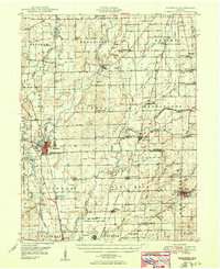
1950 Map of Edinburg
USGS Topo · Published 1950About this map
Edinburg serves as a central hub on this mid-century survey, situated at the confluence of the Blue River and Sugar Creek where they meet to form the Driftwood River. The landscape is a complex network of agriculture and water management, defined by numerous family-named drainage projects like Thompson Ditch and Fisher Ditch. This era shows the significant military footprint of the Camp Atterbury Military Reservation and the Atterbury Air Force Base, which flank the western settlements.
Find a feature on this map
100 named features on this map. Tap any name to fly to it.
Don’t see what you’re looking for? This feature index may not catch every label — zoom into the map to look around manually.
Map Details
Editions of this 1950 Edinburg Map
2 editions found
Other maps of this area

1942 · Franklin
USGS Topo · 1:125,000

1942 · Columbus
USGS Topo · 1:125,000

1947 · Franklin
USGS Topo · 1:62,500

1947 · Hope
USGS Topo · 1:24,000

1948 · Franklin
USGS Topo · 1:24,000

1948 · Edinburg
USGS Topo · 1:24,000

1948 · New Bellsville
USGS Topo · 1:24,000

1948 · Hope
USGS Topo · 1:24,000

1948 · Nineveh
USGS Topo · 1:24,000

1948 · Lewis Creek
USGS Topo · 1:24,000