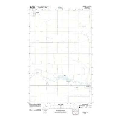
2011 Map of Edinburg
USGS Topo · Published 2011About this map
Edinburg and the northern portion of Park River anchor this survey of the North Dakota plains, illustrating the geometric precision of the region's agricultural road network. The landscape is defined by the winding course of the South Branch Park River, which is interrupted by the Homme Dam to create the Homme Reservoir. This water body is a central landmark for local geography, featuring distinct landforms such as Walsh Point and Grandview Point. Near the riverbanks, Park River Camp and the Park River Municipal Airport serve as localized hubs for recreation and transit. North of the river, the small settlement of Kerry and the Calvary Cemetery sit amidst a grid of section lines, including County Rd 9 and County Rd 11, reflecting the organized expansion of Walsh County's rural communities into the 21st century.
Find a feature on this map
33 named features on this map. Tap any name to fly to it.
Don’t see what you’re looking for? This feature index may not catch every label — zoom into the map to look around manually.
Map Details
Editions of this 2011 Edinburg Map
This is the sole edition of this map. No revisions or reprints were ever made.
Other maps of this area

1944 · Crystal
USGS Topo · 1:62,500

1952 · Thief River Falls
USGS Topo · 1:250,000

1956 · Thief River Falls
USGS Topo · 1:250,000

1957 · Thief River Falls
USGS Topo · 1:250,000

1963 · Crystal
USGS Topo · 1:24,000

1963 · Edinburg
USGS Topo · 1:24,000

1963 · Pleasant Valley
USGS Topo · 1:24,000

1963 · Gardar
USGS Topo · 1:24,000

1963 · Pisek
USGS Topo · 1:24,000

1963 · Park River
USGS Topo · 1:24,000