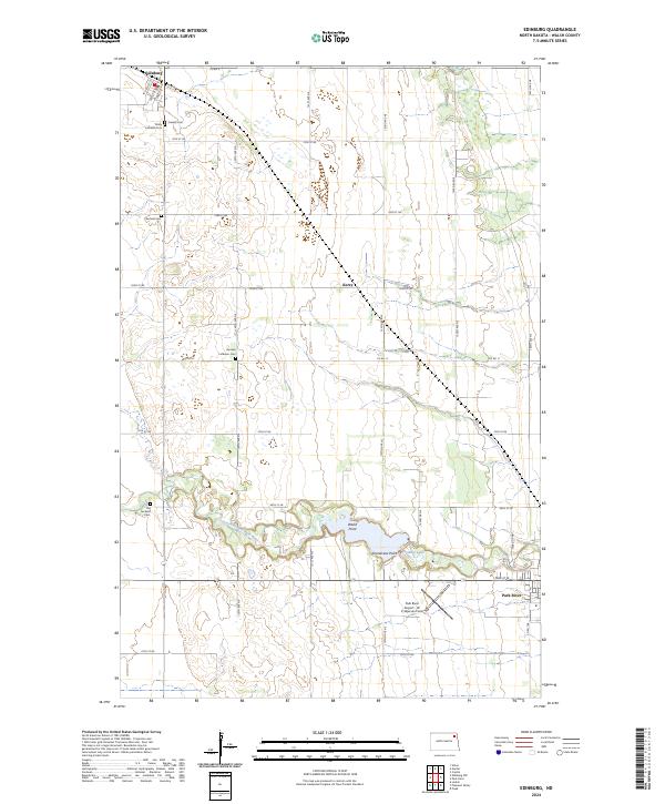
2024 Map of Edinburg
USGS Topo · Published 2024About this map
Edinburg serves as the northern anchor of this Walsh County landscape, situated amidst a grid of agricultural section lines and rural cemeteries that reflect the area's deep-rooted Lutheran heritage. The South Branch Park River meanders eastward across the southern portion of the sheet, widening into the reservoir of Homme Lake. This water body is defined by prominent geographical features such as Walsh Point and Grandview Point, offering a rare break in the flat prairie terrain. To the southeast, the outskirts of the town of Park River appear alongside the Park River Airport - W C Skjerven Field. Between these primary hubs lies the small siding of Kerry, connected by the rail corridor that cuts diagonally across the township. Genealogists will find the distribution of burial sites particularly notable, including Trinity Lutheran Cem, Calvary Cem, and the separated Garfield Cem and Old Garfield Cem locations.
Find a feature on this map
28 named features on this map. Tap any name to fly to it.
Don’t see what you’re looking for? This feature index may not catch every label — zoom into the map to look around manually.
Map Details
Editions of this 2024 Edinburg Map
This is the sole edition of this map. No revisions or reprints were ever made.
Other maps of this area

1944 · Crystal
USGS Topo · 1:62,500

1952 · Thief River Falls
USGS Topo · 1:250,000

1956 · Thief River Falls
USGS Topo · 1:250,000

1957 · Thief River Falls
USGS Topo · 1:250,000

1963 · Crystal
USGS Topo · 1:24,000

1963 · Edinburg
USGS Topo · 1:24,000

1963 · Pleasant Valley
USGS Topo · 1:24,000

1963 · Gardar
USGS Topo · 1:24,000

1963 · Pisek
USGS Topo · 1:24,000

1963 · Park River
USGS Topo · 1:24,000