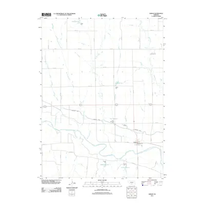
2011 Map of Edison
USGS Topo · Published 2011About this map
Edison and its surrounding agricultural valley are defined by the meandering Republican River and a complex system of water management. The landscape is heavily shaped by the Cambridge Canal, which cuts across the terrain to support local farming operations. This 2011 survey illustrates the persistent importance of small-scale water storage in the region, featuring several family-named landmarks such as Gregg Reservoir, Ziebell Reservoir, Paine Reservoir, and Broeker Reservoir.
Find a feature on this map
37 named features on this map. Tap any name to fly to it.
Don’t see what you’re looking for? This feature index may not catch every label — zoom into the map to look around manually.
Map Details
Editions of this 2011 Edison Map
This is the sole edition of this map. No revisions or reprints were ever made.
Other maps of this area

1896 · Arapahoe
USGS Topo · 1:125,000

1898 · Arapahoe
USGS Topo · 1:125,000

1955 · Grand Island
USGS Topo · 1:250,000

1957 · Grand Island
USGS Topo · 1:250,000

1958 · Grand Island
USGS Topo · 1:250,000

1958 · Edison
USGS Topo · 1:24,000

1958 · Hollinger
USGS Topo · 1:24,000
1958 · Arapahoe
USGS Topo · 1:24,000
1958 · Hendley
USGS Topo · 1:24,000
1958 · Beaver City
USGS Topo · 1:24,000