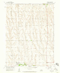
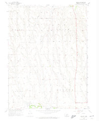
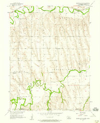
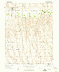
1958 Map of Hendley
USGS Topo · Published 1959About this map
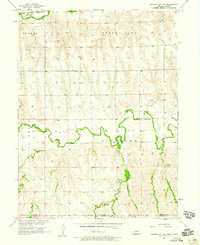
Hendley and the surrounding agricultural townships of Furnas County were mapped in the late 1950s as part of a broader Missouri River Basin development study. The landscape is defined by the valley of Beaver Creek, where the Chicago Burlington and Quincy railroad line tracks the southern watercourse, connecting the village to the wider grain-shipping network of the era. The township boundaries of Vincent, Union, Lynden, and Eureka divide a terrain of rolling hills and creek drainages, including the northern Crum Creek. Genealogists will find interest in the centrally located Pleasantview Cem and the small rural crossroads at Deerfield Corner, providing a clear record of the area's mid-century settlement pattern before significant rural consolidation changed the local geography.
Find a feature on this map
10 named features on this map. Tap any name to fly to it.
Don’t see what you’re looking for? This feature index may not catch every label — zoom into the map to look around manually.
Map Details
Editions of this 1958 Hendley Map
2 editions found
Other maps of this area

1896 · Arapahoe
USGS Topo · 1:125,000

1898 · Arapahoe
USGS Topo · 1:125,000

1954 · McCook
USGS Topo · 1:250,000

1955 · Grand Island
USGS Topo · 1:250,000

1957 · McCook
USGS Topo · 1:250,000

1957 · Grand Island
USGS Topo · 1:250,000
1957 · Beaver City SW
USGS Topo · 1:24,000
1957 · Wilsonville
USGS Topo · 1:24,000
1957 · Beaver City SE
USGS Topo · 1:24,000

1958 · McCook
USGS Topo · 1:250,000