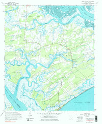
1960 Map of Edisto Island
USGS Topo · Published 1984About this map
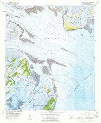
The sea island landscape of Edisto Island is defined by a dense network of tidal waterways including the North Edisto River and South Edisto River. At the time of this 1960 field check, the interior of the island was dotted with community centers such as Freedman and Little Edisto, supported by numerous local congregations like Greater Calvary Ch, Mt Olive Ch, and Bethlehem Ch. The layout of the island shows a reliance on water access, visible in features like Steamboat Landing and the Intracoastal Waterway cutting through Jehossee Island.
Find a feature on this map
57 named features on this map. Tap any name to fly to it.
Don’t see what you’re looking for? This feature index may not catch every label — zoom into the map to look around manually.
Map Details
Editions of this 1960 Edisto Island Map
3 editions found
Other maps of this area

1919 · Edisto Island
USGS Topo · 1:62,500

1919 · Wadmelaw Island
USGS Topo · 1:62,500

1920 · St. Helena Sound
USGS Topo · 1:62,500

1943 · Edisto Island
USGS Topo · 1:62,500

1944 · Wadmelaw Island
USGS Topo · 1:62,500

1947 · Savannah
USGS Topo · 1:250,000

1948 · St. Helena Sound
USGS Topo · 1:62,500

1948 · Savannah
USGS Topo · 1:250,000
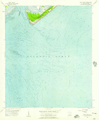
1956 · Edisto Beach
USGS Topo · 1:24,000
1956 · St. Helena Sound
USGS Topo · 1:24,000