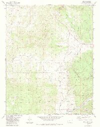
1984 Map of Edith
USGS Topo · Published 1984About this map
The Colorado-New Mexico border defines the geography of this 1980s survey, where the settlement of Edith sits near the banks of the Navajo River. The landscape is shaped by deep canyons and high plateaus, including Archuleta Mesa and Mesa del Medio, within the southeastern reaches of the San Juan National Forest. A notable presence in the north and east is the Old Grade Railroad, its path tracing the contours of Kenney Flats and Boone Creek as a remnant of earlier transport networks.
Find a feature on this map
36 named features on this map. Tap any name to fly to it.
Don’t see what you’re looking for? This feature index may not catch every label — zoom into the map to look around manually.
Map Details
Editions of this 1984 Edith Map
2 editions found
Other maps of this area

1889 · Largo
USGS Topo · 1:250,000

1895 · Largo
USGS Topo · 1:250,000

1913 · Summitville
USGS Topo · 1:125,000

1915 · Summitville
USGS Topo · 1:125,000

1924 · Pagosa Springs
USGS Topo · 1:125,000

1927 · Pagosa Springs
USGS Topo · 1:125,000

1945 · Durango
USGS Topo · 1:250,000

1953 · Durango
USGS Topo · 1:250,000

1954 · Durango
USGS Topo · 1:250,000

1954 · Aztec
USGS Topo · 1:250,000