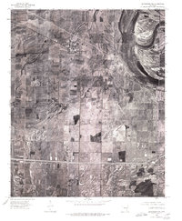
1975 Map of Edmondson NE
USGS Topo · Published 1976About this map
Crawfordsville anchors the northwestern portion of this 1970s orthophotograph, where the agricultural landscape of Crittenden County is meticulously captured from aerial imagery. The sheet illustrates the geometric patterns of the Delta's farming tradition, showing the transition from large cultivated fields to the smaller rural clusters at Vincent and Julius. In the south, the transit corridor near Lehi is clearly visible, while the community of Ebony sits along the eastern edge of the quadrangle. Produced by the U.S. Geological Survey in cooperation with the Arkansas Geological Commission, this map provides a literal visual record of the land surface, documenting drainage patterns, property lines, and the density of farmstead settlements during a period of modern agricultural expansion in Eastern Arkansas.
Find a feature on this map
5 named features on this map. Tap any name to fly to it.
Don’t see what you’re looking for? This feature index may not catch every label — zoom into the map to look around manually.
Map Details
Editions of this 1975 Edmondson NE Map
This is the sole edition of this map. No revisions or reprints were ever made.
Other maps of this area

1916 · Memphis
USGS Topo · 1:62,500

1925 · Memphis
USGS Topo · 1:48,000

1927 · Memphis
USGS Topo · 1:62,500

1931 · Jericho
USGS Topo · 1:62,500

1939 · Jericho
USGS Topo · 1:62,500

1939 · Edmondson
USGS Topo · 1:62,500

1939 · Memphis
USGS Topo · 1:62,500

1940 · Deckerville
USGS Topo · 1:62,500

1952 · Jericho
USGS Topo · 1:62,500

1953 · Memphis
USGS Topo · 1:250,000