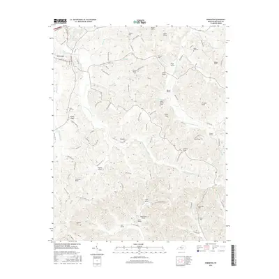
2016 Map of Edmonton
USGS Topo · Published 2016About this map
Edmonton serves as the focal point of this Metcalfe County landscape, where the S Fork Little Barren River and the E Fork Little Barren River carve a complex network of ridges and hollows. The settlement pattern follows the high ground, with historic communities like Cedar Flats and Curtis established along the winding ridges. The map reveals a deeply dissected terrain characterized by family-named landmarks such as Silas Barnes Ridge, Callahan Ridge, and Mosby Ridge. Local history is anchored by the Cedar Flats Cem and Mosby Ridge Cem, which sit atop their respective hills near the headwaters of numerous small tributaries. From the prominence of Society Hill in the north to the industrial legacy suggested by Lime Kiln Hill in the south, the map documents a rural Kentucky environment shaped by its hydrology and traditional ridge-top road networks.
Find a feature on this map
109 named features on this map. Tap any name to fly to it.
Don’t see what you’re looking for? This feature index may not catch every label — zoom into the map to look around manually.
Map Details
Editions of this 2016 Edmonton Map
This is the sole edition of this map. No revisions or reprints were ever made.
Other maps of this area

1953 · Gradyville
USGS Topo · 1:24,000

1953 · Sulphur Well
USGS Topo · 1:24,000

1953 · Sulphur Lick
USGS Topo · 1:24,000

1953 · Breeding
USGS Topo · 1:24,000

1953 · Waterview
USGS Topo · 1:24,000

1953 · Edmonton
USGS Topo · 1:24,000

1953 · Summer Shade
USGS Topo · 1:24,000

1953 · Dubre
USGS Topo · 1:24,000

1953 · East Fork
USGS Topo · 1:24,000

1956 · Corbin
USGS Topo · 1:250,000