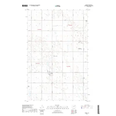
2017 Map of Edmore
USGS Topo · Published 2017About this map
Edmore serves as the primary hub of this Ramsey County landscape, characterized by the intricate drainage systems of the northern prairies. The town is flanked by essential community landmarks including the Edmore Cem to its south and Saint Ansgar Cem to the east, providing a clear window into the local genealogy and settlement history. The terrain is defined by the winding paths of Nekoma Coulee and its East Branch, along with Edmore Coulee, which carve subtle depressions through the agricultural grid. A network of rural section roads, such as Co Hwy 9 and 105th Ave NE, organizes the vast open spaces, reflecting the enduring township and range system that has shaped North Dakota's land use for generations. The distribution of small wetlands and coulees alongside these straight-edged roads highlights the intersection of natural hydrology and human-imposed geometry.
Find a feature on this map
25 named features on this map. Tap any name to fly to it.
Don’t see what you’re looking for? This feature index may not catch every label — zoom into the map to look around manually.
Map Details
Editions of this 2017 Edmore Map
This is the sole edition of this map. No revisions or reprints were ever made.
Other maps of this area
1953 · Devils Lake
USGS Topo · 1:250,000
1956 · Devils Lake
USGS Topo · 1:250,000
1970 · Alsen SE
USGS Topo · 1:24,000
1972 · Derrick
USGS Topo · 1:24,000
1972 · Derrick SE
USGS Topo · 1:24,000
1972 · Edmore SW
USGS Topo · 1:24,000
1972 · Nekoma
USGS Topo · 1:24,000
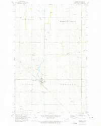
1972 · Edmore
USGS Topo · 1:24,000
1972 · Edmore NE
USGS Topo · 1:24,000
1972 · Billings Lake
USGS Topo · 1:24,000