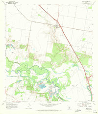
1969 Map of Edroy
USGS Topo · Published 1972About this map
The Missouri Pacific railroad corridor anchors the small settlement of Edroy during the late 1960s, where local life centered around the Guadalupe Ch and the nearby Edroy Cem. This coastal bend landscape is defined by the winding course of the Nueces River, which creates distinctive landforms like Griffin Island and Odem Island as it forms the boundary between San Patricio and Nueces counties. The industrial character of the era is evident in the extensive Riverside Oil Field and Odem Oil Field, alongside numerous Gravel Pits concentrated near the riverbanks. Beyond the energy infrastructure, the map details utility and public works developments such as the Corpus Christi Filtration Plant and the riverside Nueces River Park, illustrating how the region managed both its natural resources and its growing suburban utility needs.
Find a feature on this map
25 named features on this map. Tap any name to fly to it.
Don’t see what you’re looking for? This feature index may not catch every label — zoom into the map to look around manually.
Map Details
Editions of this 1969 Edroy Map
2 editions found
Other maps of this area

1925 · Robstown
USGS Topo · 1:62,500

1927 · Mathis
USGS Topo · 1:62,500

1950 · Corpus Christi
USGS Topo · 1:250,000

1953 · Beeville
USGS Topo · 1:250,000

1954 · Orange Grove
USGS Topo · 1:62,500

1954 · Robstown
USGS Topo · 1:62,500

1954 · Mathis
USGS Topo · 1:62,500

1954 · Sinton
USGS Topo · 1:62,500

1956 · Corpus Christi
USGS Topo · 1:250,000

1956 · Beeville
USGS Topo · 1:250,000