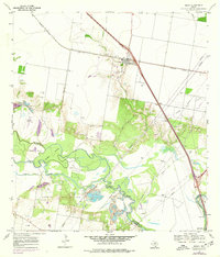
1969 Map of Edroy
USGS Topo · Published 1977About this map
The Nueces River winds through the heart of this landscape, defining the boundary between San Patricio and Nueces counties and creating distinct landforms like Griffin Island and Odem Island. In the late 1960s, the region's economy was anchored by the Riverside Oil Field and Odem Oil Field, where numerous Oil Wells and Gas Wells dot the terrain. The settlement of Edroy serves as a local hub, featuring the Guadalupe Ch, Edroy Cem, and a stop along the Missouri Pacific railroad. To the southeast, the Corpus Christi Filtration Plant near Calallen Dam highlights the vital role of the river in supporting regional infrastructure. Traces of older transport routes are evident in a north-south line marked Abandoned, contrasting with the active rail and road networks that converge at Edroy.
Find a feature on this map
28 named features on this map. Tap any name to fly to it.
Don’t see what you’re looking for? This feature index may not catch every label — zoom into the map to look around manually.
Map Details
Editions of this 1969 Edroy Map
2 editions found
Other maps of this area

1925 · Robstown
USGS Topo · 1:62,500

1927 · Mathis
USGS Topo · 1:62,500

1950 · Corpus Christi
USGS Topo · 1:250,000

1953 · Beeville
USGS Topo · 1:250,000

1954 · Orange Grove
USGS Topo · 1:62,500

1954 · Robstown
USGS Topo · 1:62,500

1954 · Mathis
USGS Topo · 1:62,500

1954 · Sinton
USGS Topo · 1:62,500

1956 · Corpus Christi
USGS Topo · 1:250,000

1956 · Beeville
USGS Topo · 1:250,000