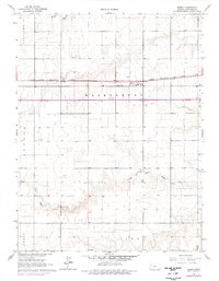
1966 Map of Edson
USGS Topo · Published 1977About this map
Edson serves as the central hub of this High Plains landscape, situated along the critical transit corridor of the Chicago Rock Island and Pacific railroad. The map illustrates a classic grid of section lines across several townships, including Washington, Voltaire, and Iowa. This agricultural geometry is softened only by the meandering drainage of the South Fork Sappa Creek and Sappa Cr as they cut through the northwestern and central reaches. The presence of the Edson Cem near the town center provides a specific point of interest for genealogists tracing early families in Sherman County. While modern developments like the 2 Lane highway are noted in later revisions, the underlying 1960s survey preserves the traditional footprint of a Kansas rail-town community and its surrounding dryland farming territory.
Find a feature on this map
11 named features on this map. Tap any name to fly to it.
Don’t see what you’re looking for? This feature index may not catch every label — zoom into the map to look around manually.
Map Details
Editions of this 1966 Edson Map
2 editions found
Other maps of this area

1954 · Goodland
USGS Topo · 1:250,000

1956 · Goodland
USGS Topo · 1:250,000

1957 · Goodland
USGS Topo · 1:250,000

1959 · Harris Draw
USGS Topo · 1:62,500

1966 · Goodland NW
USGS Topo · 1:24,000

1966 · Goodland
USGS Topo · 1:24,000

1966 · Edson
USGS Topo · 1:24,000

1966 · Goodland NE
USGS Topo · 1:24,000

1966 · Brewster NW
USGS Topo · 1:24,000

1966 · Brewster
USGS Topo · 1:24,000