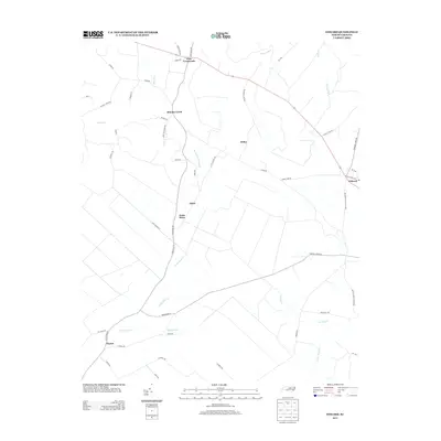
2013 Map of Edward
USGS Topo · Published 2013About this map
Coxs Crossroads sits at the northern intersection of this coastal plain landscape, where agricultural fields are divided by a complex network of wetlands and small tributaries. The drainage patterns of Blounts Creek and Little Swift Creek define the low-lying terrain, characterized by features like Poundpole Swamp Branch and Bushy Fork. Moving south, the settlement of Egypt and the landmark at Jones Store provide evidence of the local rural economy and social hubs centered around crossroad junctions. The map documents a landscape transitioning from the more densely settled northern section near Stilley toward the drainage basins of Durham Creek and Upper Broad Creek. This documentation of Beaufort County topography shows how road names like Stilley Town Road and Labor Camp Road preserve the history of community labor and family lineages in the region.
Find a feature on this map
53 named features on this map. Tap any name to fly to it.
Don’t see what you’re looking for? This feature index may not catch every label — zoom into the map to look around manually.
Map Details
Editions of this 2013 Edward Map
This is the sole edition of this map. No revisions or reprints were ever made.
Other maps of this area

1901 · New Bern
USGS Topo · 1:62,500

1902 · Vanceboro
USGS Topo · 1:62,500

1903 · New Bern
USGS Topo · 1:62,500

1904 · Vanceboro
USGS Topo · 1:62,500

1905 · Vanceboro
USGS Topo · 1:62,500

1950 · Aurora
USGS Topo · 1:24,000

1950 · Edward
USGS Topo · 1:24,000

1951 · Bath
USGS Topo · 1:24,000

1951 · Hackney
USGS Topo · 1:24,000

1953 · Blounts Bay
USGS Topo · 1:24,000