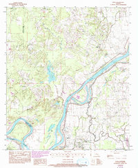
1993 Map of Effie
USGS Topo · Published 1993About this map
The Red River cuts a sweeping path through the heart of the central Louisiana landscape, defining the boundaries and the drainage patterns for the communities of Effie and Fifth Ward. This 1993 revision reveals a region where life is oriented around the river's meanders and the many oxbow lakes and bayous it has left in its wake, including Gin Lake, Cannon Lake, and Bordelon Lake. The settlement pattern follows the higher ground near these water bodies, connected by local routes like Louisiana Highway 1195 and 1194.
Find a feature on this map
46 named features on this map. Tap any name to fly to it.
Don’t see what you’re looking for? This feature index may not catch every label — zoom into the map to look around manually.
Map Details
Editions of this 1993 Effie Map
This is the sole edition of this map. No revisions or reprints were ever made.
Other maps of this area

1935 · Lecompte
USGS Topo · 1:62,500

1940 · Marksville
USGS Topo · 1:62,500

1941 · Alexandria
USGS Topo · 1:62,500

1941 · Buckeye
USGS Topo · 1:62,500

1953 · Alexandria
USGS Topo · 1:250,000

1955 · Alexandria
USGS Topo · 1:250,000

1957 · Alexandria
USGS Topo · 1:62,500

1957 · Lecompte
USGS Topo · 1:62,500

1959 · Buckeye
USGS Topo · 1:62,500
1962 · Marksville
USGS Topo · 1:62,500