
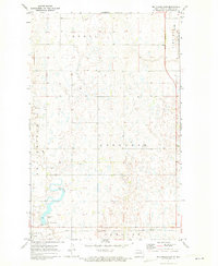
1962 Map of Egeland SW
USGS Topo · Published 1963About this map
Mauvais Coulee meanders through this portion of Towner County, North Dakota, defining the drainage patterns of a landscape marked by numerous small wetlands and glacial depressions. This 1962 field-checked survey reveals an agricultural terrain partitioned by township lines T. 159 N. and T. 158 N., where family-named land divisions like Gerrard, Paulson, Olson, and Cando reflect the era's rural land tenure. The Great Northern rail corridor cuts through the southwestern corner, providing the vital transportation link for this prairie region. Industrial activity is visible in the scattered Gravel Pits concentrated near the coulee, likely serving local road construction and maintenance needs during the early 1960s. The map captures the quiet, systematic development of the Missouri River Basin project, emphasizing the importance of water management and resource extraction in the Great Plains.
Find a feature on this map
9 named features on this map. Tap any name to fly to it.
Don’t see what you’re looking for? This feature index may not catch every label — zoom into the map to look around manually.
Map Details
Editions of this 1962 Egeland SW Map
This is the sole edition of this map. No revisions or reprints were ever made.
Other maps of this area

1953 · Devils Lake
USGS Topo · 1:250,000

1956 · Devils Lake
USGS Topo · 1:250,000

1957 · Cando
USGS Topo · 1:24,000

1957 · Cando NE
USGS Topo · 1:24,000

1962 · Egeland SE
USGS Topo · 1:24,000

1962 · Egeland
USGS Topo · 1:24,000

1962 · Snyder Lake
USGS Topo · 1:24,000

1971 · Considine
USGS Topo · 1:24,000

1971 · Leeds NE
USGS Topo · 1:24,000
1971 · Big Coulee Dam
USGS Topo · 1:24,000