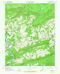
1965 Map of Eggleston
USGS Topo · Published 1967About this map
Mountain Lake sits high on the plateau of Jefferson National Forest in this mid-1960s study of the Giles and Montgomery county line. The landscape is defined by the deep gorge of the New River, where the Norfolk and Western railroad tracks follow the river's winding path past the riverside settlement of Eggleston. The map reveals a community structured around rural churches and family-named ridges, including Hoges Chapel and the Spruce Run Ch.
Find a feature on this map
55 named features on this map. Tap any name to fly to it.
Don’t see what you’re looking for? This feature index may not catch every label — zoom into the map to look around manually.
Map Details
Editions of this 1965 Eggleston Map
Other maps of this area

1890 · Dublin
USGS Topo · 1:125,000

1890 · Christiansburg
USGS Topo · 1:125,000

1891 · Dublin
USGS Topo · 1:125,000

1923 · Pearisburg
USGS Topo · 1:62,500

1923 · Waiteville
USGS Topo · 1:62,500

1931 · Waiteville
USGS Topo · 1:48,000

1932 · Pearisburg
USGS Topo · 1:48,000

1932 · Blacksburg
USGS Topo · 1:48,000

1937 · Pearisburg
USGS Topo · 1:62,500

1937 · Blacksburg
USGS Topo · 1:62,500