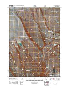
2011 Map of Egli Rim
USGS Topo · Published 2011About this map
Egli Rim defines the eastern verticality of this high desert landscape in Lake County, dropping toward the expansive bed of Silver Lake. The environment is shaped by the search for water in an arid basin, evidenced by a series of critical livestock and wildlife resources including Weaver Waterhole, Rocky Waterhole, and Muddy Waterhole. Human infrastructure in the area is minimal, centered primarily on water management and ranching access via County Hwy 4-15. Drainage is dominated by the seasonal paths of Willow Creek, while the Egli Rim Reservoir Number Two serves as a significant engineered catchment beneath the rim. This 2011 survey by the U.S. Geological Survey and U.S. Forest Service captures a sparsely populated region where geography is primarily marked by named buttes and ephemeral water sources.
Find a feature on this map
11 named features on this map. Tap any name to fly to it.
Don’t see what you’re looking for? This feature index may not catch every label — zoom into the map to look around manually.
Map Details
Editions of this 2011 Egli Rim Map
This is the sole edition of this map. No revisions or reprints were ever made.
Other maps of this area

1955 · Crescent
USGS Topo · 1:250,000

1955 · Klamath Falls
USGS Topo · 1:250,000

1957 · Crescent
USGS Topo · 1:250,000

1958 · Crescent
USGS Topo · 1:250,000

1958 · Klamath Falls
USGS Topo · 1:250,000

1966 · Summer Lake
USGS Topo · 1:24,000

1966 · Foster Butte
USGS Topo · 1:24,000

1970 · Crescent
USGS Topo · 1:250,000

1974 · Lake Abert
USGS Topo · 1:100,000

1981 · Thorn Lake
USGS Topo · 1:24,000