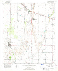
1957 Map of El Mirage
USGS Topo · Published 1967About this map
Luke Air Force Base dominates the southern landscape of this mid-century survey, its expansive grounds and Landing Strip established as a major military presence in the Salt River Valley. The surrounding area shows a patchwork of agricultural development and early suburban platting, particularly around Youngtown and El Mirage. Irrigation is central to the local economy, evidenced by the Bethany Home Road Canal and numerous unnamed reservoirs dotting the desert floor between the Agua Fria River and the New River.
Find a feature on this map
37 named features on this map. Tap any name to fly to it.
Don’t see what you’re looking for? This feature index may not catch every label — zoom into the map to look around manually.
Map Details
Editions of this 1957 El Mirage Map
5 editions found

Other maps of this area

1912 · Phoenix
USGS Topo · 1:62,500

1914 · Phoenix
USGS Topo · 1:62,500

1946 · Avondale
USGS Topo · 1:62,500

1948 · Cashion
USGS Topo · 1:62,500

1952 · Fowler
USGS Topo · 1:24,000

1952 · Phoenix
USGS Topo · 1:62,500

1954 · Phoenix
USGS Topo · 1:250,000

1957 · Phoenix
USGS Topo · 1:250,000

1957 · Perryville
USGS Topo · 1:24,000

1957 · Calderwood Butte
USGS Topo · 1:24,000