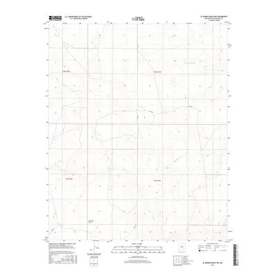
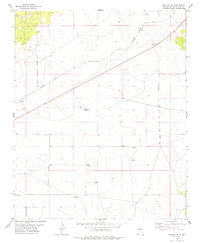
2017 Map of El Morro Ranch NW
USGS Topo · Published 2017About this map
San Pablo Draw defines the southern landscape of this high plains region in Guadalupe County, where subtle elevation changes guide seasonal drainage across the arid terrain. The map documents a sparsely populated ranching territory during the mid-2010s, characterized by vast sections of open land organized under the Public Land Survey System. In the northern reaches, the ephemeral Cañada de Brehedo cuts through the topography, while a limited network of gravel and dirt routes such as 3 Wall Rd and Topaz Rd provide the only significant access through these expansive ranch lands. This geographic record is essential for understanding contemporary land use and the persistent rural character of eastern New Mexico, highlighting how road names like Perez Rd reflect the local history and family legacy of the area.
Find a feature on this map
10 named features on this map. Tap any name to fly to it.
Don’t see what you’re looking for? This feature index may not catch every label — zoom into the map to look around manually.
Map Details
Editions of this 2017 El Morro Ranch NW Map
This is the sole edition of this map. No revisions or reprints were ever made.
Other maps of this area

1954 · Fort Sumner
USGS Topo · 1:250,000

1958 · Fort Sumner
USGS Topo · 1:250,000
1978 · El Morro Ranch SE
USGS Topo · 1:24,000
1978 · Tapia Ranch
USGS Topo · 1:24,000
1978 · El Morro Ranch
USGS Topo · 1:24,000
1978 · Laguna De Los Terreros
USGS Topo · 1:24,000
1978 · Pastura
USGS Topo · 1:24,000
1978 · El Morro Ranch NW
USGS Topo · 1:24,000
1978 · Long Draw
USGS Topo · 1:24,000
1978 · Pastura SE
USGS Topo · 1:24,000