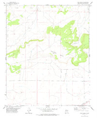
1978 Map of Tapia Ranch
USGS Topo · Published 1978About this map
Argonne Mesa dominates the central landscape of this Guadalupe County survey, rising sharply above the surrounding high plains. The arid terrain is defined by deep incisions like Collins Canyon and the winding course of the Pintada Arroyo to the north. Evidence of livestock ranching is central to the area's identity, anchored by the Tapia Ranch near the base of the mesa and the intricate topography of Rincon de Rosendo. Transportation across this expansive territory is represented by the Southern Pacific tracks cutting across the southern portion of the quadrangle. This map documents a quiet, traditional ranching landscape in the late 1970s, where seasonal drainages and named canyons serve as the primary landmarks for local navigation and land boundaries.
Find a feature on this map
9 named features on this map. Tap any name to fly to it.
Don’t see what you’re looking for? This feature index may not catch every label — zoom into the map to look around manually.
Map Details
Editions of this 1978 Tapia Ranch Map
This is the sole edition of this map. No revisions or reprints were ever made.
Other maps of this area

1954 · Fort Sumner
USGS Topo · 1:250,000

1958 · Fort Sumner
USGS Topo · 1:250,000
1978 · George Ranch
USGS Topo · 1:24,000

1978 · Mesa Leon
USGS Topo · 1:24,000
1978 · Pintada
USGS Topo · 1:24,000
1978 · San Ignacio
USGS Topo · 1:24,000
1978 · Milagro
USGS Topo · 1:24,000
1978 · Pastura
USGS Topo · 1:24,000

1978 · El Morro Ranch NW
USGS Topo · 1:24,000
1978 · Burro Lake
USGS Topo · 1:24,000