
1959 Map of El Paso
USGS Topo · Published 1968About this map
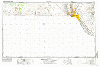
El Paso serves as the focal point of this regional study, which tracks the international border between the United States and Mexico and the extensive military presence during the late 1950s. The urban core and surrounding valley show the vital role of irrigation, with the Rio Grande feeding the Franklin Canal and Riverside Canal to support desert agriculture. To the northeast, the Fort Bliss Military Reservation and Biggs Air Force Base occupy a massive footprint, reflecting the area's strategic defense importance.
Find a feature on this map
60 named features on this map. Tap any name to fly to it.
Don’t see what you’re looking for? This feature index may not catch every label — zoom into the map to look around manually.
Map Details
Editions of this 1959 El Paso Map
2 editions found
Other maps of this area

1891 · Las Cruces
USGS Topo · 1:125,000

1893 · Las Cruces
USGS Topo · 1:125,000

1894 · Fort Hancock
USGS Topo · 1:125,000

1896 · El Paso
USGS Topo · 1:125,000

1896 · Rio Grande
USGS Topo · 1:125,000

1899 · Deming
USGS Topo · 1:125,000

1903 · Cerro Alto
USGS Topo · 1:125,000

1908 · El Paso
USGS Topo · 1:125,000

1915 · Deming
USGS Topo · 1:125,000

1917 · Hermanas
USGS Topo · 1:62,500