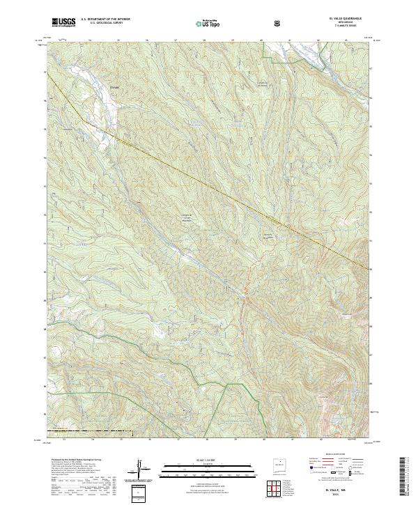
2023 Map of El Valle
USGS Topo · Published 2023About this map
El Valle and Vallecitos serve as primary points of habitation in this high-altitude landscape where the Sangre de Cristo Mountains meet the Santa Fe Mountains. The map reveals a complex traditional irrigation network, featuring systems such as the Acequia Madre de Llano San Juan and Acequia de Abajo de el Valle, which draw from local watercourses like the Rio de las Trampas. These acequias reflect a long-standing agricultural tradition within the mountain valleys, sustaining communities at the edge of the Carson National Forest. Further south, the terrain rises into the high peaks of the Pecos Wilderness, including Trampas Peak and Jicarilla Peak. The presence of several trick tanks, such as the Osha Ridge Trick Tank and Cebadilla Trick Tank, points to the management of water for livestock and wildlife in this remote alpine environment.
Find a feature on this map
44 named features on this map. Tap any name to fly to it.
Don’t see what you’re looking for? This feature index may not catch every label — zoom into the map to look around manually.
Map Details
Editions of this 2023 El Valle Map
This is the sole edition of this map. No revisions or reprints were ever made.
Other maps of this area

1889 · Santa Fe
USGS Topo · 1:125,000

1894 · Santa Fe
USGS Topo · 1:125,000

1953 · Truchas
USGS Topo · 1:24,000

1953 · Sierra Mosca
USGS Topo · 1:24,000

1953 · Trampas
USGS Topo · 1:24,000

1954 · Santa Fe
USGS Topo · 1:250,000

1954 · Raton
USGS Topo · 1:250,000

1958 · Raton
USGS Topo · 1:250,000

1958 · Santa Fe
USGS Topo · 1:250,000
1963 · Truchas Peak
USGS Topo · 1:24,000