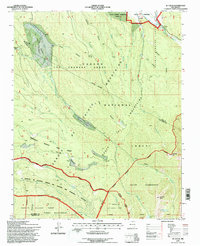
1995 Map of El Valle
USGS Topo · Published 1997About this map
El Valle and its intricate water management system anchor the landscape of northern New Mexico in the mid-1990s. The village is defined by gravity-fed irrigation channels like the Acequia de Abajo de El Valle and Acequia de la Plaza, which draw from the Rio de las Trampas to support local agriculture. This network reflects a centuries-old tradition of communal water rights essential to life in the Sangre de Cristo Mountains.
Find a feature on this map
54 named features on this map. Tap any name to fly to it.
Don’t see what you’re looking for? This feature index may not catch every label — zoom into the map to look around manually.
Map Details
Editions of this 1995 El Valle Map
This is the sole edition of this map. No revisions or reprints were ever made.
Other maps of this area

1889 · Santa Fe
USGS Topo · 1:125,000

1894 · Santa Fe
USGS Topo · 1:125,000

1953 · Truchas
USGS Topo · 1:24,000

1953 · Sierra Mosca
USGS Topo · 1:24,000

1953 · Trampas
USGS Topo · 1:24,000

1954 · Santa Fe
USGS Topo · 1:250,000

1954 · Raton
USGS Topo · 1:250,000

1958 · Raton
USGS Topo · 1:250,000

1958 · Santa Fe
USGS Topo · 1:250,000
1963 · Truchas Peak
USGS Topo · 1:24,000