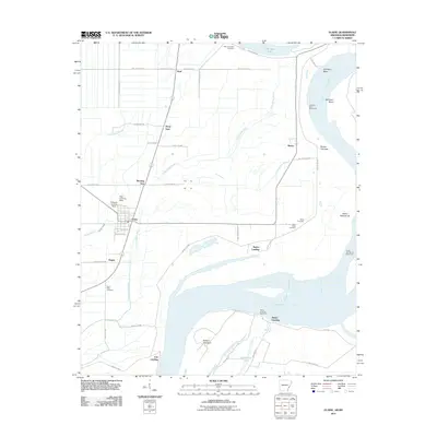
2011 Map of Elaine
USGS Topo · Published 2011About this map
The Mississippi River dominates the eastern and southern reaches of this landscape, defining the boundaries and character of Phillips County. Its history of shifting channels is visible in the sweeping curve of Old Town Bend and the engineered defenses at Oldtown Bend Revetment and Island Number 62 Revetment. Inland, the alluvial plain is marked by a network of waterways including Yellow Bank Bayou and Govan Slough, which drain the flat agricultural lands around the town of Elaine.
Find a feature on this map
52 named features on this map. Tap any name to fly to it.
Don’t see what you’re looking for? This feature index may not catch every label — zoom into the map to look around manually.
Map Details
Editions of this 2011 Elaine Map
This is the sole edition of this map. No revisions or reprints were ever made.
Other maps of this area

1930 · Mellwood
USGS Topo · 1:62,500

1935 · Clarksdale
USGS Topo · 1:62,500

1939 · Farrell
USGS Topo · 1:62,500

1939 · Modoc
USGS Topo · 1:62,500

1939 · Clarksdale
USGS Topo · 1:62,500

1939 · Mellwood
USGS Topo · 1:62,500

1948 · Helena
USGS Topo · 1:250,000

1948 · Modoc
USGS Topo · 1:62,500

1950 · Helena
USGS Topo · 1:250,000

1954 · Mellwood
USGS Topo · 1:62,500