2024 Map of Elaine
USGS Topo · Published 2024About this map
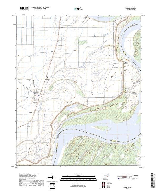
The town of Elaine anchors this agricultural landscape along the Arkansas-Mississippi state line, defined by the winding course of the Mississippi River and its remnant oxbows. The river's influence is evident in features like Old Town Bend and the Modoc Crevasse, illustrating the dynamic nature of the delta floodplain. Smaller settlements and agricultural hubs like Ewal, Hoop Spur, and Modoc are connected by an extensive grid of county roads, including Phillips Road 425 and Phillips Road 452.
Find a feature on this map
64 named features on this map. Tap any name to fly to it.
Don’t see what you’re looking for? This feature index may not catch every label — zoom into the map to look around manually.
Map Details
Editions of this 2024 Elaine Map
This is the sole edition of this map. No revisions or reprints were ever made.