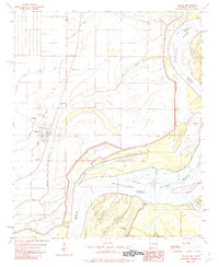
1982 Map of Elaine
USGS Topo · Published 1982About this map
Elaine serves as the primary hub in this Mississippi River delta landscape, where the floodplain is defined by intricate waterways like Govan Slough and Yellow Bank Bayou. The area's agricultural and social fabric is revealed through small clusters such as Hoop Spur, Modoc, and Dixie, alongside numerous rural spiritual centers including the Church of God and Morning Star Ch. This survey illustrates the constant tension between the land and the Mississippi River, visible in the prominent curve of Swan Lake and the shifting channels around Robson Towhead.
Find a feature on this map
35 named features on this map. Tap any name to fly to it.
Don’t see what you’re looking for? This feature index may not catch every label — zoom into the map to look around manually.
Map Details
Editions of this 1982 Elaine Map
This is the sole edition of this map. No revisions or reprints were ever made.
Other maps of this area

1930 · Mellwood
USGS Topo · 1:62,500

1935 · Clarksdale
USGS Topo · 1:62,500

1939 · Farrell
USGS Topo · 1:62,500

1939 · Modoc
USGS Topo · 1:62,500

1939 · Clarksdale
USGS Topo · 1:62,500

1939 · Mellwood
USGS Topo · 1:62,500

1948 · Helena
USGS Topo · 1:250,000

1948 · Modoc
USGS Topo · 1:62,500

1950 · Helena
USGS Topo · 1:250,000

1954 · Mellwood
USGS Topo · 1:62,500