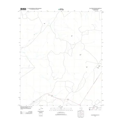
2012 Map of Elam Mountain
USGS Topo · Published 2012About this map
Titley and Stroebel mark the few points of settlement in this arid reach of Brewster County, where the landscape is defined by the high relief of the Trans-Pecos. The terrain is dominated by prominent volcanic features, most notably Elam Mtn, House Mtn, and Cone Mtn, which rise sharply from the desert floor. The drainage patterns are equally distinct, with Alpine Cr winding through the western portion of the quadrangle while Ramsey Draw and Emerson Draw catch seasonal runoff to the east. Transportation is limited to a sparse network of roads that navigate the basins between these peaks, reflecting the ranching and livestock heritage of the region. This 2012 survey provides a clear view of the relationship between the rugged topography and the intermittent water sources that have dictated human activity in West Texas for generations.
Find a feature on this map
8 named features on this map. Tap any name to fly to it.
Don’t see what you’re looking for? This feature index may not catch every label — zoom into the map to look around manually.
Map Details
Editions of this 2012 Elam Mountain Map
This is the sole edition of this map. No revisions or reprints were ever made.
Other maps of this area

1894 · Fort Davis
USGS Topo · 1:125,000

1895 · Alpine
USGS Topo · 1:125,000

1897 · Fort Davis
USGS Topo · 1:125,000

1923 · Altuda
USGS Topo · 1:62,500

1929 · Hovey
USGS Topo · 1:125,000

1954 · Fort Stockton
USGS Topo · 1:250,000

1958 · Fort Stockton
USGS Topo · 1:250,000

1972 · Bird Mountain
USGS Topo · 1:24,000

1972 · Alpine North
USGS Topo · 1:24,000

1972 · Alpine South
USGS Topo · 1:24,000