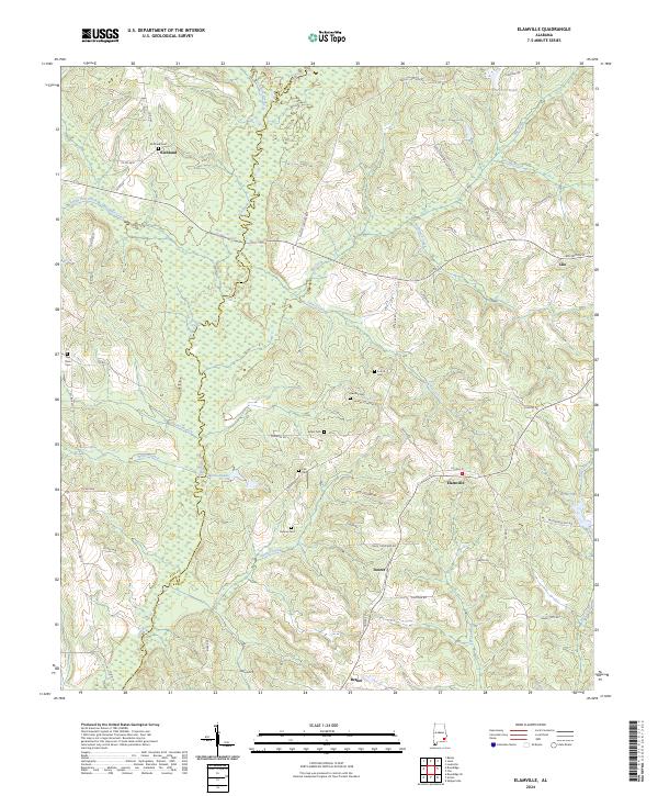
2024 Map of Elamville
USGS Topo · Published 2024About this map
The Pea River winds through the border between Barbour and Pike counties, defining a landscape of creek bottoms and small agricultural settlements. This modern survey shows the enduring footprint of rural communities like Elamville, Richland, and Doster, which are connected by a network of local routes such as Alto Shipman Rd and Dansby Cemetery Rd. The terrain is deeply carved by water, with Big Creek, Richland Creek, and Danner Creek feeding into the larger river system, while local impoundments like Jacksons Pond and Easterlings Pond serve the countryside.
Find a feature on this map
71 named features on this map. Tap any name to fly to it.
Don’t see what you’re looking for? This feature index may not catch every label — zoom into the map to look around manually.
Map Details
Editions of this 2024 Elamville Map
This is the sole edition of this map. No revisions or reprints were ever made.
Other maps of this area

1948 · Brundidge
USGS Topo · 1:62,500

1950 · Brundidge
USGS Topo · 1:62,500

1953 · Dothan
USGS Topo · 1:250,000

1954 · Dothan
USGS Topo · 1:250,000

1955 · Dothan
USGS Topo · 1:250,000

1960 · Brundidge
USGS Topo · 1:24,000

1960 · Brundidge SE
USGS Topo · 1:24,000

1962 · Brundidge
USGS Topo · 1:25,000
1962 · Brundidge SE
USGS Topo · 1:25,000

1968 · Louisville
USGS Topo · 1:24,000