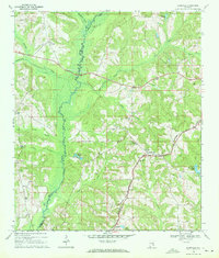
1969 Map of Elamville
USGS Topo · Published 1971About this map
The Pea River carves a winding path through the borderlands of Barbour and Pike counties, defining a landscape of low-lying wetlands and well-drained agricultural ridges. This rural Alabama territory in the late 1960s was anchored by the small communities of Elamville, Richland, and Doster, connected by a network of unimproved roads and the Central of Georgia rail line. The map reveals a high density of small family and community landmarks, particularly evident in the concentration of churches and associated burial grounds like St Pauls Cem Ch and Sweet Oak Ch Cem. To the west, Buckhorn Creek and Richland Creek feed the main river, while the eastern portion of the quadrangle is defined by smaller drainages such as Thompson Creek and Judy Creek. The prevalence of sites like Sutton Cem and Danner Cem provides significant primary data for researchers tracing family history in this corner of the Wiregrass region.
Find a feature on this map
35 named features on this map. Tap any name to fly to it.
Don’t see what you’re looking for? This feature index may not catch every label — zoom into the map to look around manually.
Map Details
Editions of this 1969 Elamville Map
This is the sole edition of this map. No revisions or reprints were ever made.
Other maps of this area

1948 · Brundidge
USGS Topo · 1:62,500

1950 · Brundidge
USGS Topo · 1:62,500

1953 · Dothan
USGS Topo · 1:250,000

1954 · Dothan
USGS Topo · 1:250,000

1955 · Dothan
USGS Topo · 1:250,000

1960 · Brundidge
USGS Topo · 1:24,000

1960 · Brundidge SE
USGS Topo · 1:24,000

1962 · Brundidge
USGS Topo · 1:25,000
1962 · Brundidge SE
USGS Topo · 1:25,000

1968 · Louisville
USGS Topo · 1:24,000