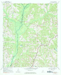
1979 Map of Elamville
USGS Topo · Published 1984About this map
The Pea River and its tributaries define the landscape of south-central Alabama in this survey of the Barbour and Pike county line. Small rural hubs like Elamville, Richland, and Doster are linked by a network of local roads and the path of the Central Of Georgia railroad. This region is marked by its numerous family-named cemeteries and community landmarks, including Sutton Cem, Dansby Cem, and Adam Cem, which offer significant value for genealogists tracing early residents of the area.
Find a feature on this map
30 named features on this map. Tap any name to fly to it.
Don’t see what you’re looking for? This feature index may not catch every label — zoom into the map to look around manually.
Map Details
Editions of this 1979 Elamville Map
This is the sole edition of this map. No revisions or reprints were ever made.
Other maps of this area

1948 · Brundidge
USGS Topo · 1:62,500

1950 · Brundidge
USGS Topo · 1:62,500

1953 · Dothan
USGS Topo · 1:250,000

1954 · Dothan
USGS Topo · 1:250,000

1955 · Dothan
USGS Topo · 1:250,000

1960 · Brundidge
USGS Topo · 1:24,000

1960 · Brundidge SE
USGS Topo · 1:24,000

1962 · Brundidge
USGS Topo · 1:25,000
1962 · Brundidge SE
USGS Topo · 1:25,000

1968 · Louisville
USGS Topo · 1:24,000