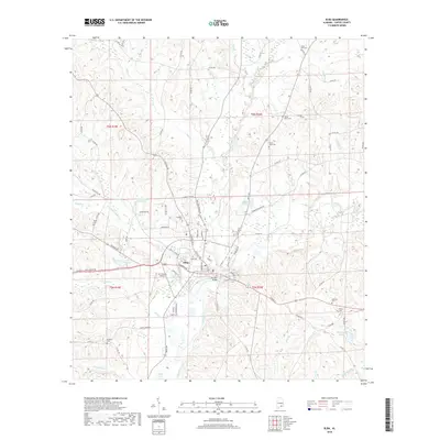
2018 Map of Elba
USGS Topo · Published 2018About this map
Elba sits at the convergence of several waterways, dominated by the winding path of the Pea River and its numerous tributaries like Whitewater Creek and Beaverdam Creek. The town's layout is defined by its relationship with these waters, which historical records show have frequently shaped its development and industrial history. Transportation infrastructure is anchored by the Carl Folsom Airport and Simmons Bridge, connecting the central settlement to a vast network of rural roads such as Hickman Ave and Old Curtis Rd.
Find a feature on this map
99 named features on this map. Tap any name to fly to it.
Don’t see what you’re looking for? This feature index may not catch every label — zoom into the map to look around manually.
Map Details
Editions of this 2018 Elba Map
This is the sole edition of this map. No revisions or reprints were ever made.
Other maps of this area

1942 · Enterprise
USGS Topo · 1:125,000

1948 · Brundidge
USGS Topo · 1:62,500

1950 · Enterprise
USGS Topo · 1:62,500

1950 · Brundidge
USGS Topo · 1:62,500

1953 · Andalusia
USGS Topo · 1:250,000

1953 · Dothan
USGS Topo · 1:250,000

1954 · Dothan
USGS Topo · 1:250,000

1955 · Dothan
USGS Topo · 1:250,000

1957 · Andalusia
USGS Topo · 1:250,000

1960 · Victoria
USGS Topo · 1:24,000