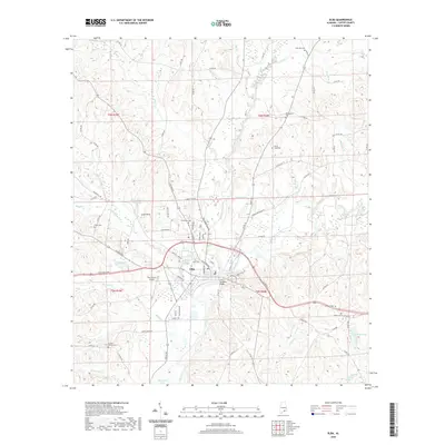
2020 Map of Elba
USGS Topo · Published 2020About this map
Pea River and Whitewater Creek converge at the heart of Elba, a community defined by its relationship with these winding waterways. This contemporary survey reveals a landscape of agricultural tradition and modern infrastructure, where the J B Simmons Bridge spans the river near the center of town. The area is dotted with several family-named landmarks and resting places, such as Wise Mill Cem to the north and Grimes-Holland Cem to the southwest, providing valuable touchpoints for genealogists. Aviation activity is centered at the Carl Folsom Airport, while recreational spots like Elba Country Club Lake and Lake Lorene break up the wooded terrain. Numerous creeks, including Beaverdam Creek and Hurricane Cr, carve out the topography of Coffee County, illustrating the natural drainage patterns that have influenced local settlement and road placement for generations.
Find a feature on this map
94 named features on this map. Tap any name to fly to it.
Don’t see what you’re looking for? This feature index may not catch every label — zoom into the map to look around manually.
Map Details
Editions of this 2020 Elba Map
This is the sole edition of this map. No revisions or reprints were ever made.
Other maps of this area

1942 · Enterprise
USGS Topo · 1:125,000

1948 · Brundidge
USGS Topo · 1:62,500

1950 · Enterprise
USGS Topo · 1:62,500

1950 · Brundidge
USGS Topo · 1:62,500

1953 · Andalusia
USGS Topo · 1:250,000

1953 · Dothan
USGS Topo · 1:250,000

1954 · Dothan
USGS Topo · 1:250,000

1955 · Dothan
USGS Topo · 1:250,000

1957 · Andalusia
USGS Topo · 1:250,000

1960 · Victoria
USGS Topo · 1:24,000