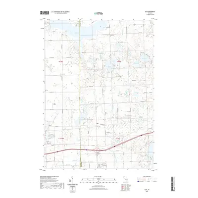
2019 Map of Elba
USGS Topo · Published 2019About this map
Elba serves as the focal point of this 2019 survey, situated in a landscape defined by an intricate network of glacial lakes and managed drainage systems. The northern reaches are dominated by the Holloway Reservoir and the Flint River, while the central and southern portions of the township are dotted with numerous water bodies including Potters Lake, Skinner Lake, and Nepessing Lake. This geography is shaped by human engineering, as evidenced by the complex system of agricultural and roadside waterways such as the Washington Drain, Lassen Drain, and the Roadway and Powelson Drain.
Find a feature on this map
123 named features on this map. Tap any name to fly to it.
Don’t see what you’re looking for? This feature index may not catch every label — zoom into the map to look around manually.
Map Details
Editions of this 2019 Elba Map
This is the sole edition of this map. No revisions or reprints were ever made.
Other maps of this area

1920 · Flint
USGS Topo · 1:62,500

1920 · Holly
USGS Topo · 1:62,500

1922 · Holly
USGS Topo · 1:62,500

1922 · Flint
USGS Topo · 1:62,500

1943 · Holly
USGS Topo · 1:62,500

1943 · Flint
USGS Topo · 1:62,500

1943 · Metamora
USGS Topo · 1:24,000

1945 · Hadley
USGS Topo · 1:24,000

1946 · Metamora
USGS Topo · 1:24,000

1954 · Detroit
USGS Topo · 1:250,000