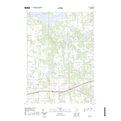
2023 Map of Elba
USGS Topo · Published 2023About this map
Holloway Reservoir and the Flint River Water Trail dominate the northern landscape of this Lapeer County region, where the Genesee County and Lapeer County line bisects a network of glacial lakes and agricultural drainages. The settlement of Elba serves as a central point for the surrounding rural area, which is notably dense with historical burial grounds including Saint John Catholic Cemetery and the German Cemetery. A complex system of waterways, from the Hammond and Misener Drain to the Treadway and Powelson Drain, illustrates the extensive land management required for the local topography. Further south, Nepessing Lake and Long Lake offer a contrast to the structured drainages, while John's Airport provides a small aviation landmark amidst the rural sections of Township 7 North, Range 8 East.
Find a feature on this map
84 named features on this map. Tap any name to fly to it.
Don’t see what you’re looking for? This feature index may not catch every label — zoom into the map to look around manually.
Map Details
Editions of this 2023 Elba Map
This is the sole edition of this map. No revisions or reprints were ever made.
Other maps of this area

1920 · Flint
USGS Topo · 1:62,500

1920 · Holly
USGS Topo · 1:62,500

1922 · Holly
USGS Topo · 1:62,500

1922 · Flint
USGS Topo · 1:62,500

1943 · Holly
USGS Topo · 1:62,500

1943 · Flint
USGS Topo · 1:62,500

1943 · Metamora
USGS Topo · 1:24,000

1945 · Hadley
USGS Topo · 1:24,000

1946 · Metamora
USGS Topo · 1:24,000

1954 · Detroit
USGS Topo · 1:250,000