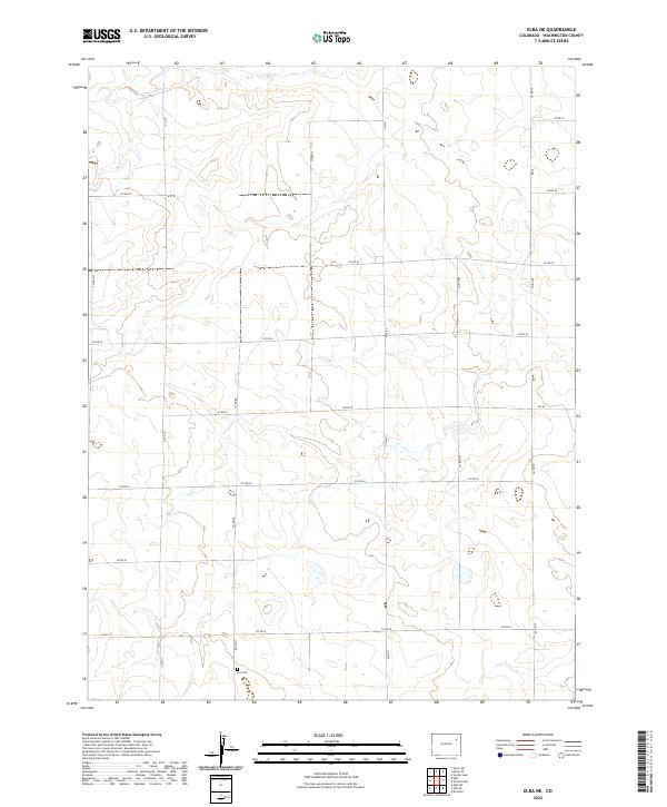
2022 Map of Elba NE
USGS Topo · Published 2022About this map
Lee Cem sits in the southern portion of this landscape, serving as a significant genealogical point of interest for researchers tracing families in this part of Washington County. The terrain is defined by the ephemeral path of Hell Cr in the north, while the remainder of the area is organized by a precise grid of county roads including Co Rd 29, Co Rd 26, and Co Rd 22. This layout reflects the enduring influence of the Public Land Survey System on the Colorado plains, where townships like t1s r51w and t2s r51w dictate the movement and settlement patterns across the high prairie. The map captures the quiet, rural character of the region, where wide-open spaces are punctuated only by these essential transit lines and isolated landmarks.
Find a feature on this map
15 named features on this map. Tap any name to fly to it.
Don’t see what you’re looking for? This feature index may not catch every label — zoom into the map to look around manually.
Map Details
Editions of this 2022 Elba NE Map
This is the sole edition of this map. No revisions or reprints were ever made.
Other maps of this area

1954 · Limon
USGS Topo · 1:250,000

1954 · Sterling
USGS Topo · 1:250,000

1957 · Limon
USGS Topo · 1:250,000

1958 · Limon
USGS Topo · 1:250,000

1958 · Sterling
USGS Topo · 1:250,000

1972 · Snyder Lake
USGS Topo · 1:24,000

1973 · Akron SE
USGS Topo · 1:24,000
1973 · Akron SW
USGS Topo · 1:24,000
1974 · Elba
USGS Topo · 1:24,000
1974 · De Nova NW
USGS Topo · 1:24,000