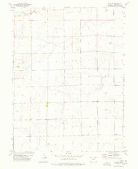
1977 Map of Elba NE
USGS Topo · Published 1978About this map
Hell Creek winds through the northern reaches of this High Plains landscape, which is defined by a sparse network of section lines and intermittent drainages. In the late 1970s, the area remained predominantly agricultural, with scattered infrastructure like the Storage Bin locations and a Gravel Pit near the creek. The presence of Lee Cem and Peniel Ch provides essential markers for local history and genealogy, identifying small social and commemorative hubs within the wide-open prairie of Washington County. Several Well sites are indicated, reflecting the critical reliance on groundwater in this arid environment.
Find a feature on this map
6 named features on this map. Tap any name to fly to it.
Don’t see what you’re looking for? This feature index may not catch every label — zoom into the map to look around manually.
Map Details
Editions of this 1977 Elba NE Map
This is the sole edition of this map. No revisions or reprints were ever made.
Other maps of this area

1954 · Limon
USGS Topo · 1:250,000

1954 · Sterling
USGS Topo · 1:250,000

1957 · Limon
USGS Topo · 1:250,000

1958 · Limon
USGS Topo · 1:250,000

1958 · Sterling
USGS Topo · 1:250,000

1972 · Snyder Lake
USGS Topo · 1:24,000

1973 · Akron SE
USGS Topo · 1:24,000
1973 · Akron SW
USGS Topo · 1:24,000
1974 · Elba
USGS Topo · 1:24,000
1974 · De Nova NW
USGS Topo · 1:24,000